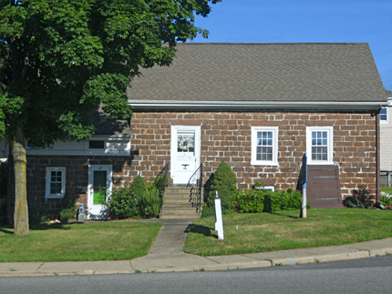


Cornelius Lozier House
Goffle Rd. and Paterson Ave.
Now in use as a business by the Brownstone Mills Shops
Map / Directions to Lozier House
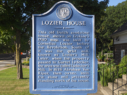
The Cornelius Lozier House was built circa 1775, and was here as the Revolutionary War activity occurred in the surrounding areas of Bergen County. The house appeared on a map of the area made in 1780 by Robert Erskine, who served as the army's Surveyor-General and produced over 200 maps for General Washington during the Revolutionary War. Erskine lived in Ringwood, NJ, and is buried there on his property, which is now Ringwood State Park. [1]
Lozier also built a grist mill (a mill for grinding wheat into flour) nearby, which no longer stands. It was replaced in 1826 by a mill built by a later owner of the property, Abraham Van Riper, which still stands behind the house. Both the house and the mill are now used as stores as part of the Brownstone Mills Shops.

1. ^ • Bergen County Historical Society historic marker
• National Register of Historic Places Inventory Nomination Form for the Lozier House and Van Riper Mill.
Available as a PDF on the National Park Service website here.• A collection of Erskine's maps can be viewed in the Archives section of the Witness to the Early American Experience website, developed by New York University Libraries in collaboration with the New-York Historical Society
The specific map where the Lozier house appears is Map #56 A. It can be hard to locate, and hard to read, but the marking for "Cornelius Lozier" appears towards the right side of the map, about 1/3 of the way down from the top of the map.